Deprecated: Function WP_Dependencies->add_data() was called with an argument that is deprecated since version 6.9.0! IE conditional comments are ignored by all supported browsers. in /home/bwattftp/1fifoto.com/cdt_hiking/wp-includes/functions.php on line 6131
Deprecated: Function WP_Dependencies->add_data() was called with an argument that is deprecated since version 6.9.0! IE conditional comments are ignored by all supported browsers. in /home/bwattftp/1fifoto.com/cdt_hiking/wp-includes/functions.php on line 6131
Deprecated: Function WP_Dependencies->add_data() was called with an argument that is deprecated since version 6.9.0! IE conditional comments are ignored by all supported browsers. in /home/bwattftp/1fifoto.com/cdt_hiking/wp-includes/functions.php on line 6131
Deprecated: Function WP_Dependencies->add_data() was called with an argument that is deprecated since version 6.9.0! IE conditional comments are ignored by all supported browsers. in /home/bwattftp/1fifoto.com/cdt_hiking/wp-includes/functions.php on line 6131
So much has happened since I last posted. Each night I check for cell signal and nada. I’ve been taking pictures to post but I’ve forgotten why I took them. All I can say is I’m still hiking and I’m almost done with the grand state of Colorado. The mountains have been very tough. So much so that I’m taking a zero day (no hiking) in Pagosa Springs CO today to recover. Then tomorrow I’ll have about 70 miles and I’ll be in New Mexico.
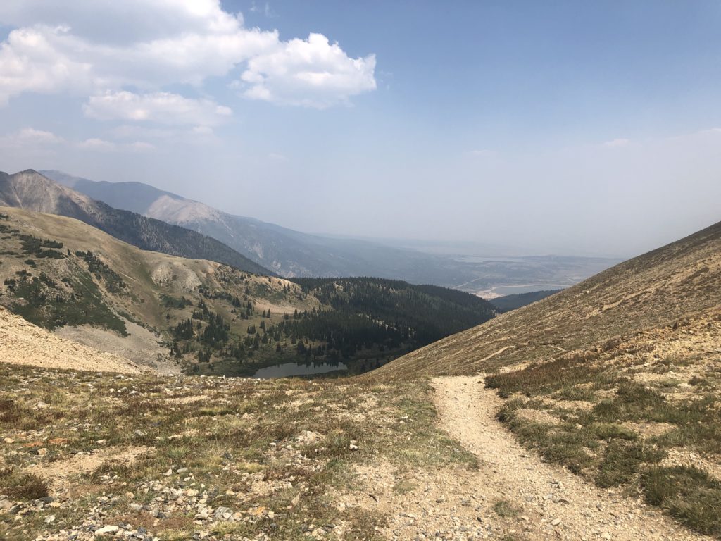
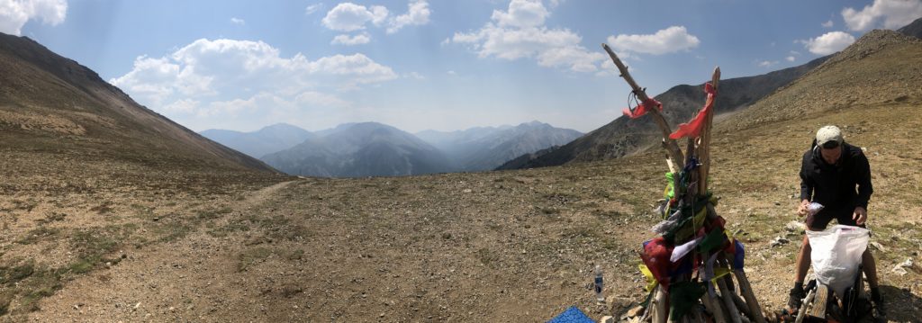
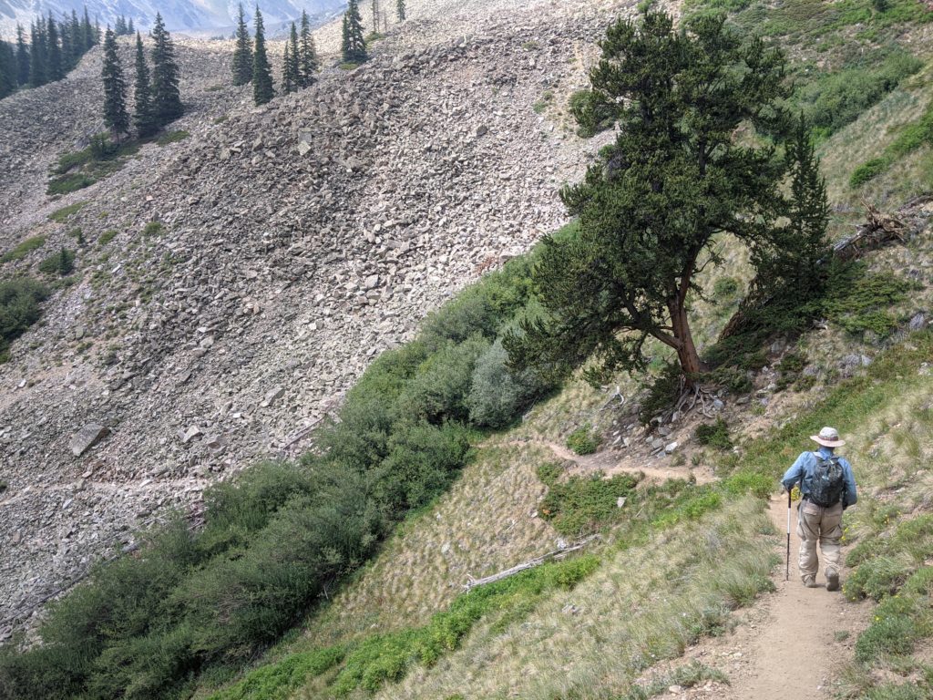
Watch the trail as it snakes up the mountain. Taken 8/14.Justin opening a can of green bean with the only tool he could find – a hatchet!Early morning cairn marking the trail near a summit. Taken 8/27
Hiking Together: Meetup: Day 35 – Sunday 8/16/2020 – 1852.6 – clear, sunny, some clouds, pleasant. I woke at the campground at 4:45 am. I used my headlamp to pack up. I put my regular backpack next to the ladder. I took my day pack and poles. On the way to the trail I stopped at the toilets. I was on trail about 5:35 am. I only had to use my headlamp for 15-20 minutes until it was light enough to see. I did wear gloves and vest to keep the chill off. I left campground and circumnavigated Twin Lakes. At the start of the Hope Pass climb I sent a message to Justin telling him I’ve started [“At 1846.6 and beginning ascent” Aug 16, 2020 10:49 AM]. Steadily I climbed without stopping for all 4100’. It took until 12:15 pm or about 37.5 minutes per mile. At the Pass Justin was not there so I sat and ate my lunch. Milkshake, another hiker, was there as was a couple. After lunch I began to descend because I was cold from sitting still. A few minutes later I met Justin on the way up. He was nearly at the summit. So I waited for him to summit and return. Then we began the arduous descent in earnest. Down and down and down on a steep and rocky trail we went. About an hour and a half of repeated braking with my poles and pressure on my poor sore ankle. When we were almost at the bottom Justin offered to Milkshake and another hiker who were hiking behind us to come to the Jeep and get sodas. They did even though they hike down and up 0.2 mile. We chatted and then they left to continue their hiking. I did my resupply, set up my tent and am trying to relax after quite a long and strenuous day.
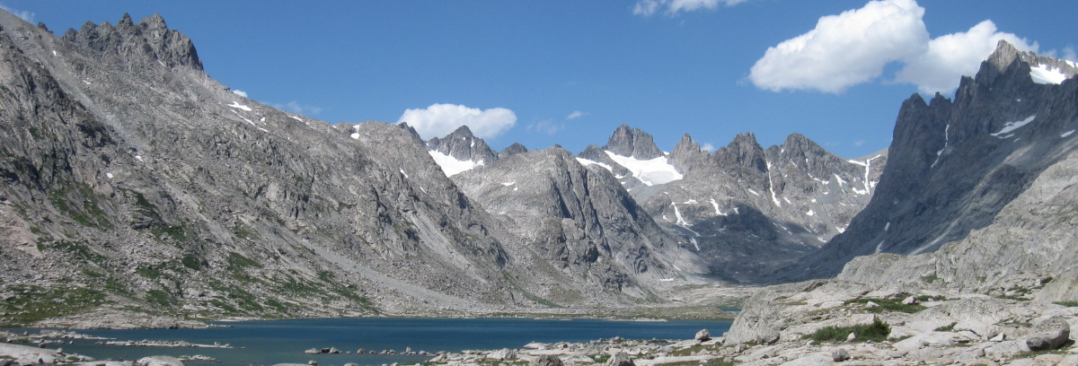
My slack-packed around the Twin Lakes and then it was a long arduous climb up Hope Pass – part of the famous Leadville 100 Ultramarathon.At Hope Pass with Buddhist/Tibetan Prayer Flags on the trail marker. Hiker next to me is getting lunch.I ate my lunch but I got cold on Hope Pass so I am heading down while looking ahead for Justin. (Photograph Courtesy of J. Watt)Only a few minute later I met Justin. While I waited for him he summited. We’re now descending together. (Photograph Courtesy of J. Watt)This side of Hope Pass is quite steep and treacherous. We descended for miles. And Justin had just ascended it. Afterwards we found out that the descent was about 1000′ per mile which is twice normal. (Photograph Courtesy of J. Watt)
Meetup: Day 34 – Saturday 8/15/2020 – 1836.8 – clear, sunny, hot, Smokey. I got up in darkness at 4:45 am. After potty I came back to my campsite and used my headlamp on red mode to pack up. I was on trail at 5:40 am with my headlamp in low-intensity white mode. The first climb was 1000’ and then down on the other side. Then a second climb but not as bad as the first. However it was getting hot. So I listened to podcasts to pass the time. Finally I got to Justin’s camp site which is about 0.2 mile off trail at about 1:45 pm. So nice to see him. Over the next few hours we changed plans for me to slack pack tomorrow. He would park on the far side of Hope Pass. Then he’d climb it and meet me at the summit. We’ve heard that there are now three Colorado forest fires burning 100 miles or more north of us and the air quality is smokey. Another great tasty dinner by Chef Justin. My tent is on a slight slope, but I’ll see how I’ll do.
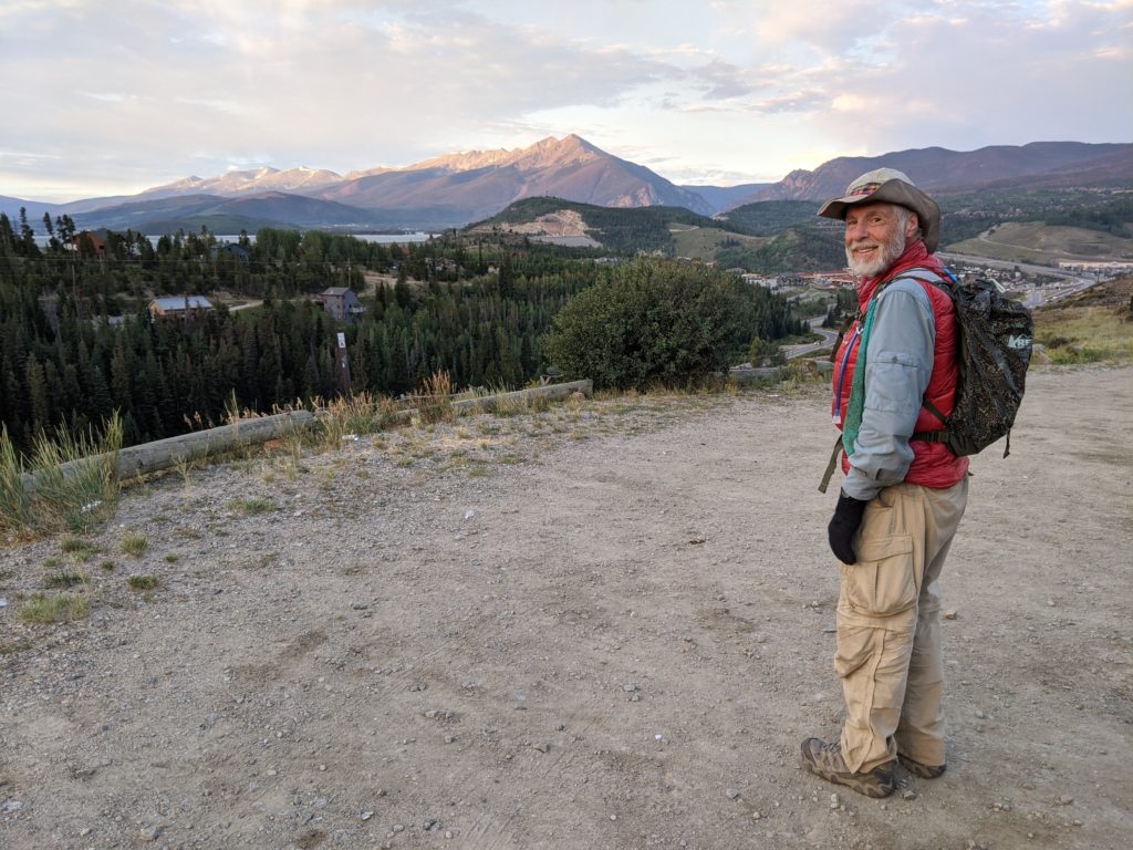
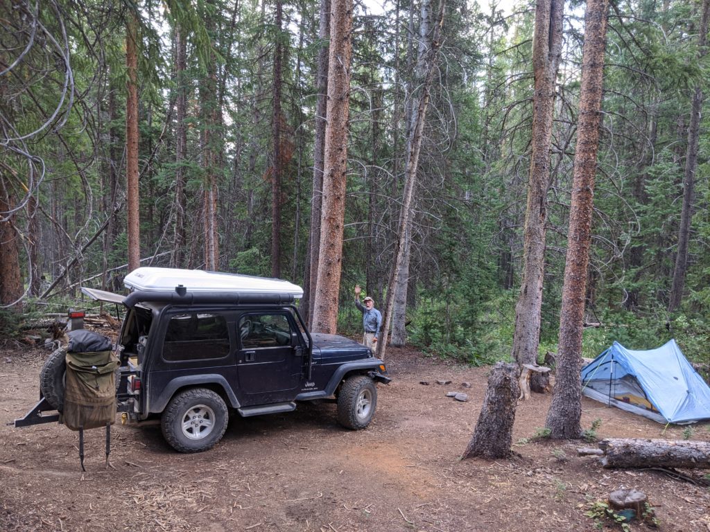
At Twin Lakes campsite for the night. My tent is behind and below me on my right. Sadly all the mountains behind me are obscured by smoke from the distant California forest fires. (Photograph Courtesy of J. Watt)Nice selfie of both of us relaxing at our campsite. (Photograph Courtesy of J. Watt)
Day 33 – Friday 8/14/2020 – 1820.2 – clear, sunny, hot. I woke on the hut’s lawn at 4:45 am. I packed up and left at 5:35 am. It was quite dark out at that time. I needed my headlamp to get back on trail. I had two major climbs. One at the start of the day and the other at the very end. I do them quite slowly and try to control my breathing so I don’t have to stop. Naturally there was a descent between them. Just before the second descent I had lunch to ensure I had some calories to burn on the next climb. The trail was very rocky. I got done about 2:15 pm. I’m near water too. I’ve been drinking lots of water afterwards. I had a big dinner with black bean salad and ramen and more water. Tomorrow I’m back in Justin’s loving care in Twin Lakes at a campground just off trail. Then the next day I hope I can maybe slack pack the first 10 miles around the lake. Then I’ve got a 3000’ climb to Hope Pass – oh my! Don’t get ahead of myself. I just have to worry about one day at a time.
Meetup: Day 32 – Thursday 8/13/2020 – 1804.7 – clear, sunny, hot. I woke at 4:45 am and was on trail around 5:45 am. I climbed to Elk Ridge which was in 3.2 miles, and then I descended until 9.8 miles where I began the climb to Tennessee Pass. Although I thought it would be an easier day I found it harder than I expected. My left ankle is hurting. I just had to ignore it. At the Pass I hurriedly got a shower. Casey and her family arrived. They went to their hut and we stayed in the parking lot to give them time to settle in. Then, because it was so hot, I also washed my dirty dirty clothes and hung them on the Jeep to dry. Next I did resupply. Finally Justin packed cooking stuff and we both went to their hut for dinner and conversation. I set up my tent about 100 feet from the hut. We ate, and chatted keeping our distance. It was fun. At 8 pm I came back to my tent to do final chores and turn in for sleep. It was a very nice day. Lots of people, a social connection, along with good food.
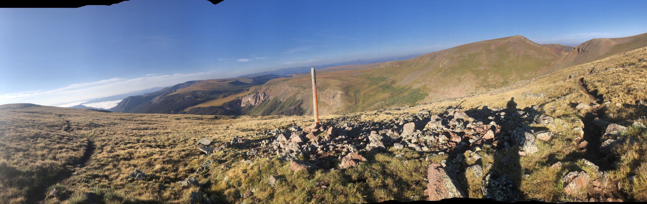
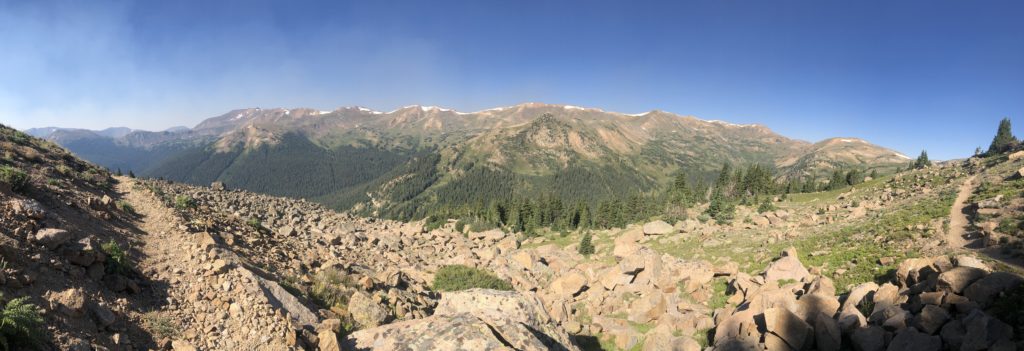
Panoramic picture heading toward Tennessee Pass early in the morning.
Hiking Together: Meetup: Day 31 – Wednesday 8/12/2020 – main trail 1787.9 – clear, cloudy, cold rain, cloudy, sunny. I woke at 4:45 am and was on trail at 5:50 am. It was a long climb to the pass. Then it was a long descent to Copper Mountain and Justin. I gave him a big Hug! We planned this to be a Stop and Go. I resupplied for one more day, filled water and had two Cokes. Justin hiked out with me around 11 am. Just as we were starting a monsoon rain cloud dumped 15 minutes of heavy rain. We waited under the eaves of the Police Station. When it had passed we began the climb out of here. Justin had already descended this trail yesterday having taken the ski lift to the top. He helped show me the way. At 1 pm or after about 3 miles we stopped for lunch. Afterward I continued on and he returned to the Jeep. I got to my campsite about 3:30 pm. It’s a little exposed but it’s in some trees and I hope it’s ok for tonight. Every so often the wind blows and rattles the tent. Tomorrow I’m shooting to get to Tennessee Pass which is 16 miles away. It looks doable.
Heading down on a long descent into Copper Mountain and a meetup with Justin.After meeting-up with Justin and a quick resupply we hiked together near Copper Mountain ski area. (Photograph Courtesy of J. Watt)Time to split up. Justin to return to the Jeep. Me to continue onward. But first I have to figure out using my Guthooks phone app if I’m on the trail and where it goes. But all I needed to do was look at the tree behind me to know that. Oh well! (Photograph Courtesy of J. Watt)One: Off I go… (Photograph Courtesy of J. Watt)Two: Off I go… (Photograph Courtesy of J. Watt)Three: Off I go… (Photograph Courtesy of J. Watt)
Day 30 – Tuesday 8/11/2920 – Silverthorne Alternative 10.1 – partially cloudy, sunny, warm. Justin and I slept overnight at a US Forest service area which was away from the trail. I woke at 5:15 am and Justin at 5:30 am. We left the campsite at 6:00 am and was back at the trailhead at 6:35 am. I slack packed the next 3 miles through Silverthorne to another trailhead on the other side of town. There I called Kathy and Katie, who was visiting, and had a nice chat with both of them. Afterwards at 8 am I headed off. Next I’ll see Justin at Copper Mountain in two days. The trail was quite flat. It came to a large waterfalls. There were day hikers there too. The trail showed I had to hand climb a steep narrow crevice. So up I went. About 10-15’ up I couldn’t find a hand hold. I was worried about falling backwards with my heavy pack on. Very carefully I found a hold and with difficulty I pull myself up. Whew! Then trail disappeared into underbrush so I scrambled through it. At last I found the actual trail. Welcome to hiking an alternate trail. From then on it would climb and then flatten, climb and flatten. At the top I could see the whole valley. As I was eating my lunch another hiker appeared who was new to section hiking. He was trying it for 8 days. He had no trail name yet. He said after my next climb it would be downhill until ten mile creek. I got to the creek at 2:45 pm. There I met a couple who were day hiking. They were from Boerne TX which is just south of Austin TX. Overall it was a good day. I was done at a reasonable time and didn’t feel like a zombie. Maybe it was because I ate my candy snack as soon as I got settled to give me some late afternoon calories. I don’t know.
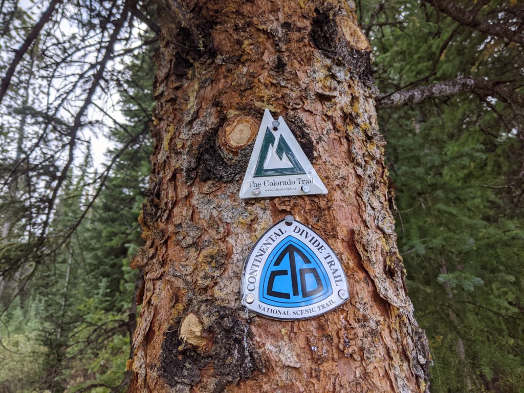
Off I go slack-packing through Silverthorne and meet Justin on the other side of town where I’ll pick up my regular pack and continue on my way. (Photograph Courtesy of J. Watt)The CDT and the Colorado Trail merge into a single combined trail. (Photograph Courtesy of J. Watt)
Meetup: Day 29 – Monday 8/10/2020 – Silverthorne Alternative 24.1 (NOBO) – clear, sunny, hot. I woke at 4:45 am and was on trail at 5:38 am. I climbed up a canyon and then climbed further. The alternative trail tends to disappear. By using Guthooks app, your eyes and luck most of the times you can find the trail again. But it is tiring and hard. This happened over and over today. In addition there were at least two big climbs and two big descents. All of them wore me out. I got to Justin around 4:15 pm. Over ten hiking hours is much much too long. I was a marching zombie. At the end seeing Justin was wonderful. It took me having some soda, dinner and rest for me to get back to normal. My feet were throbbing. I took an Advil tonight to help them. In my opinion by not having the alternate’s elevation in the app is awful. I can’t plan how to expend my energy. Justin made a delightful Indian dish for dinner. He also glued the tips of my hiking shoes to hold them together. I’m ready to slack-pack through Silverthorne tomorrow.
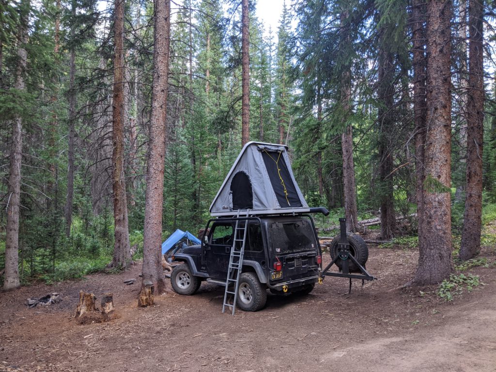
Down a U.S. Forest Service road thanks to our trusty Jeep we got to our dispersed campsite. (Photograph Courtesy of J. Watt)We are getting ready for bed. My tent is set up and Justin’s roof-top tent is popped-up. (Photograph Courtesy of J. Watt)
Day 28 – Sunday 8/9/2020 – from main trail 1704.3 and start of Silverthorne Alternative 44.7 (NOBO) to Silverthorne Alternative 39.6 (NOBO) – clear, sunny, windy above tree line, hot below. I didn’t sleep well, because I had a hard time getting to sleep. I woke several time during the night. Twice to pee. The full moon almost gone. It is dark now in the mornings. I got up at 4:30 am and was on trail about 5:30 am. After packing up my tent in the trees I went to the Jeep for breakfast. I crossed the road and started climbing. Today I had two major climbs and a bunch of smaller ones. Just slowly I got them done. I met Greg and Laura who are section hikers. They had heard about me and how I was being support by Justin. It was the trail gossip. They told me that all they had to do was get to James Wilderness Preserve sign in 11 miles and THEY WILL COMPLETE THE ENTIRE CDT. I said a big congratulations to them. This is a very significant and emotional achievement. At Silverthorne alternative cut-off I ate lunch around 12:30 pm. It took me 7 hours to do about 12 miles. The alternative started with a long downhill road walk in the noon day heat and then became a trail. Slowly it climbed up the valley. Almost at my day’s end I met three hikers camping NOBO. One was called Magic Pack. He had a map and I asked about the elevation because Guthooks was clueless. They told me that tomorrow would be two high climbs. Finally at 3:00 pm I was happy to be done hiking for the day. It had been a long one.
Panoramic picture on a mountain side after Vasquez Peak and shortly before the Silverthorne alternative turnoff.