Days in Rocks-a-lot

Climbing up to the Knife Edge. Each day I don’t know what I’ll encounter. In this case I didn’t expect this boulder field. But what’s a hiker going to do – give up, nope slowly make your way through each obstacle.
Up, up, up… Look for and follow the white blazes wherever they lead.
Across the Knife Edge!
It rainEd yesterday night. I climbed above the misty clouds. Good morning sun!
Crossing the Lehigh River and looking up knowing I’d soon be climbing up there. Little did I realize that a massive boulder field awaits.
During the climb out of Palmerton PA. A massive boulder field and the trail went up and up and up. There were times when my hiking poles were an encumbrance and hands, knees and butt did the job. Was I scared? You bet’cha!
I couldn’t help myself. I had to stop several times to munch on wild raspberries along the trail. My fingers were purple afterwards. Yum!

1200 miles

I thought this was a pretty picture because the foreground trees frame the shot and the distant haze has a pink glow
I made it to mile 1200 on June 29th.

Beaver dam

Inside the Rausch Gap Shelter.
I walked through the mud and muck at the edge of a hundred yard Beaver Dam. My main worry – DON’T FALL! Smelly wet feet. And I wasn’t the only one to wade through this mess even though there was a detour somewhere before.
I like bridges. Here is another one I crossed over a nice river.
Sitting under Interstate 81 eating a snack and drink before a 1000’ climb.

Duncannon PA

Near Boiling Springs PA I walked through fields and meadows.
High above Duncannon PA about to descend.
Hundreds of uneven stone steps down down down into Duncannon PA. I’m going there to resupply at Mutzabaughs Grocery..
Walking across the Susquehanna River while talking to Kathy on my phone which was held ever so tightly so as to not fall in the river.
High above the Susquehanna River back hiking on the ridge.

Half way

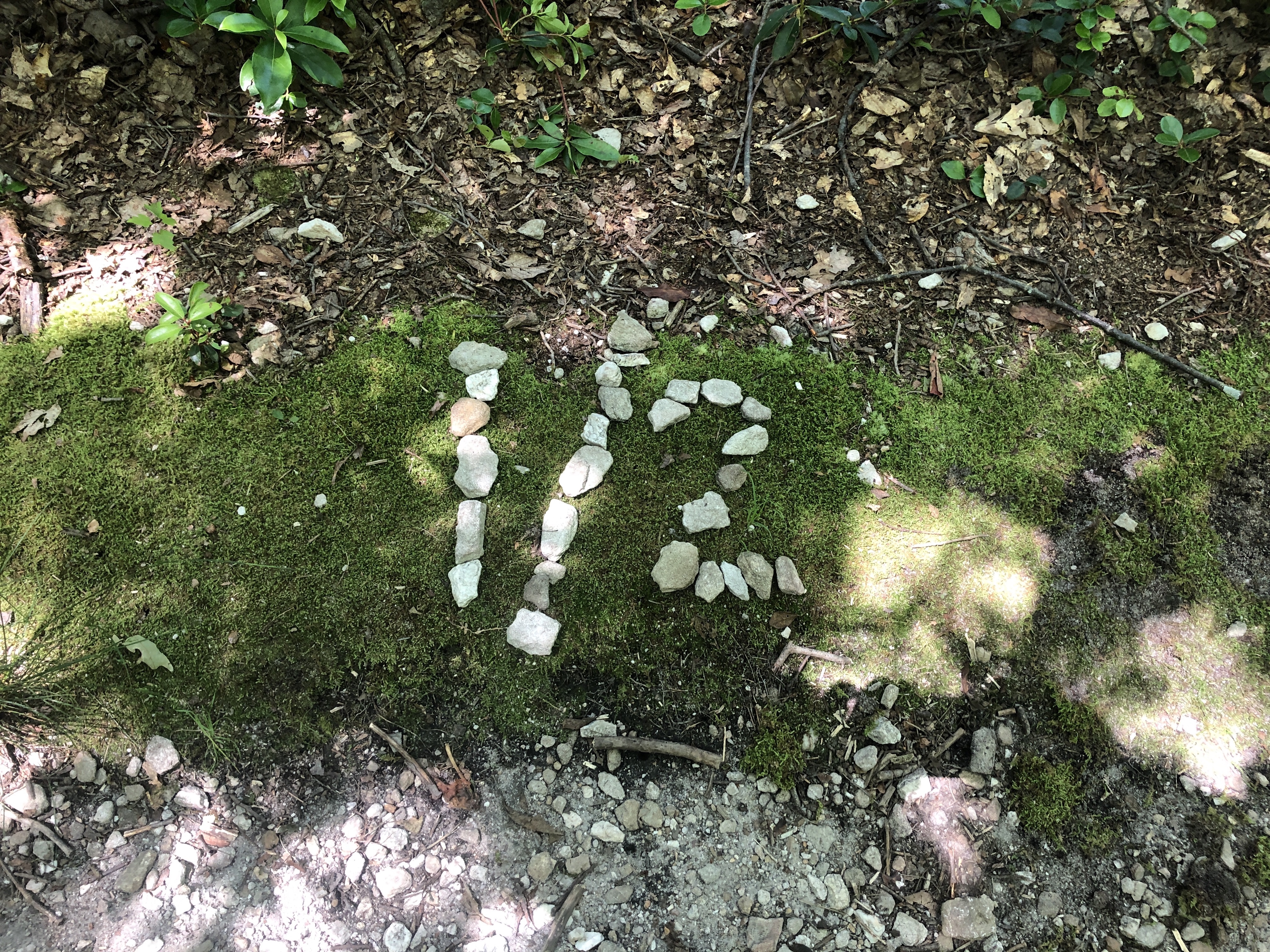
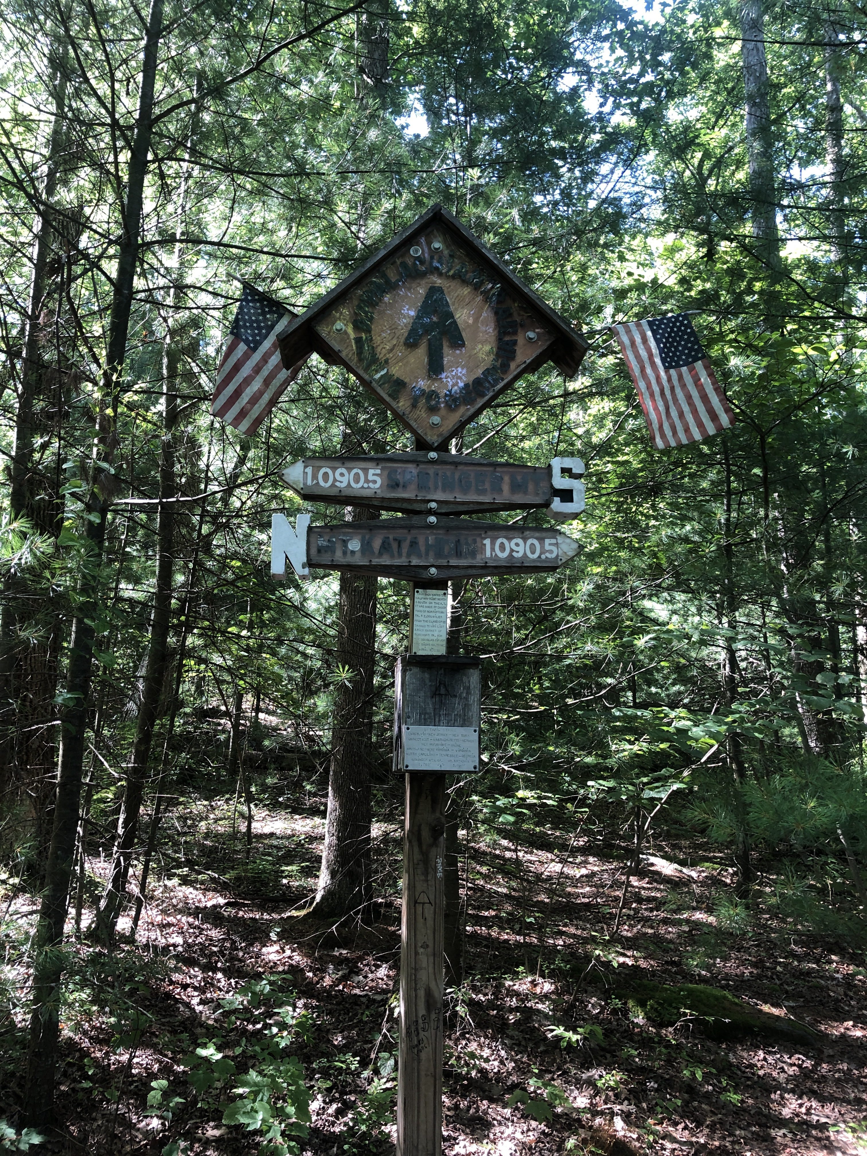
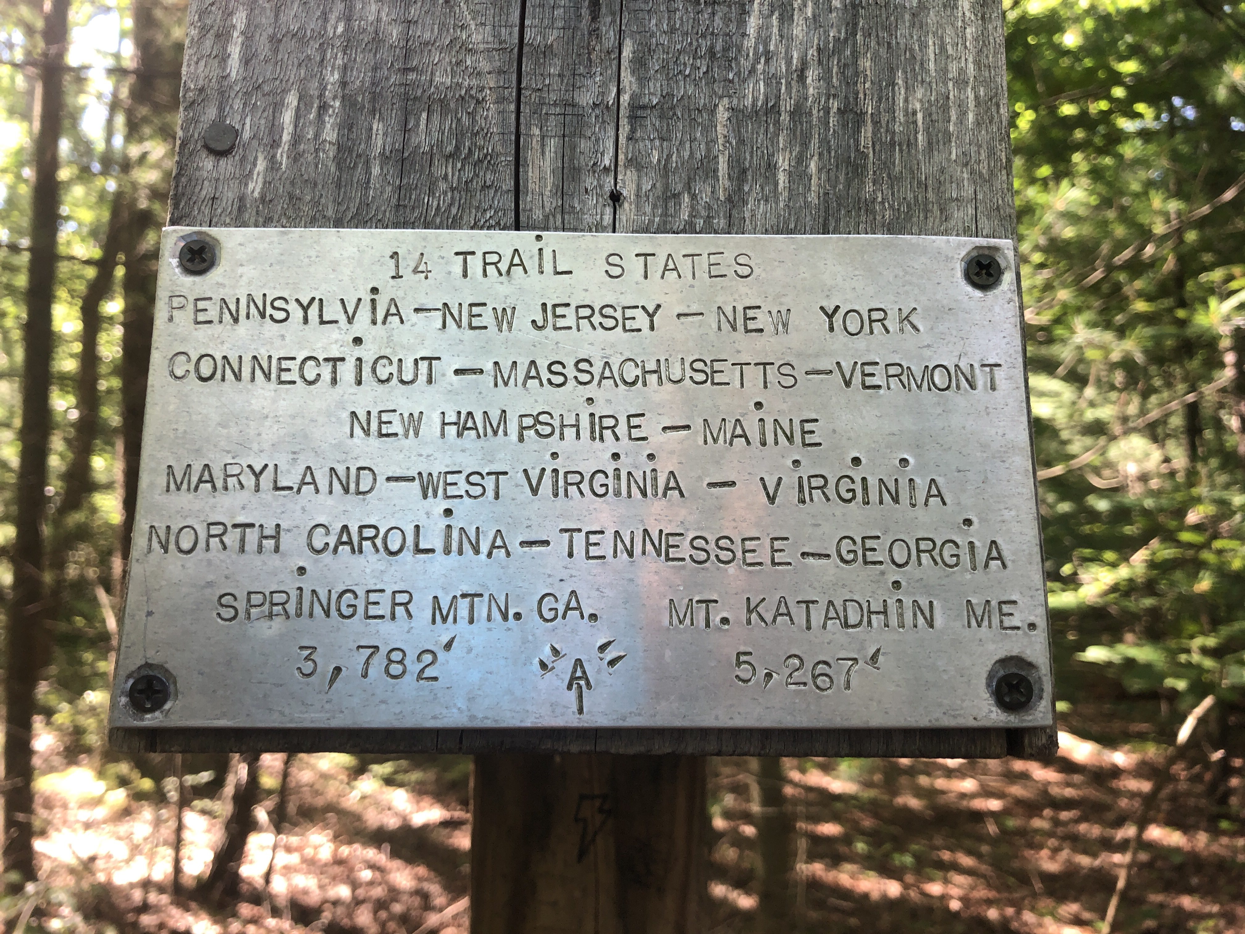
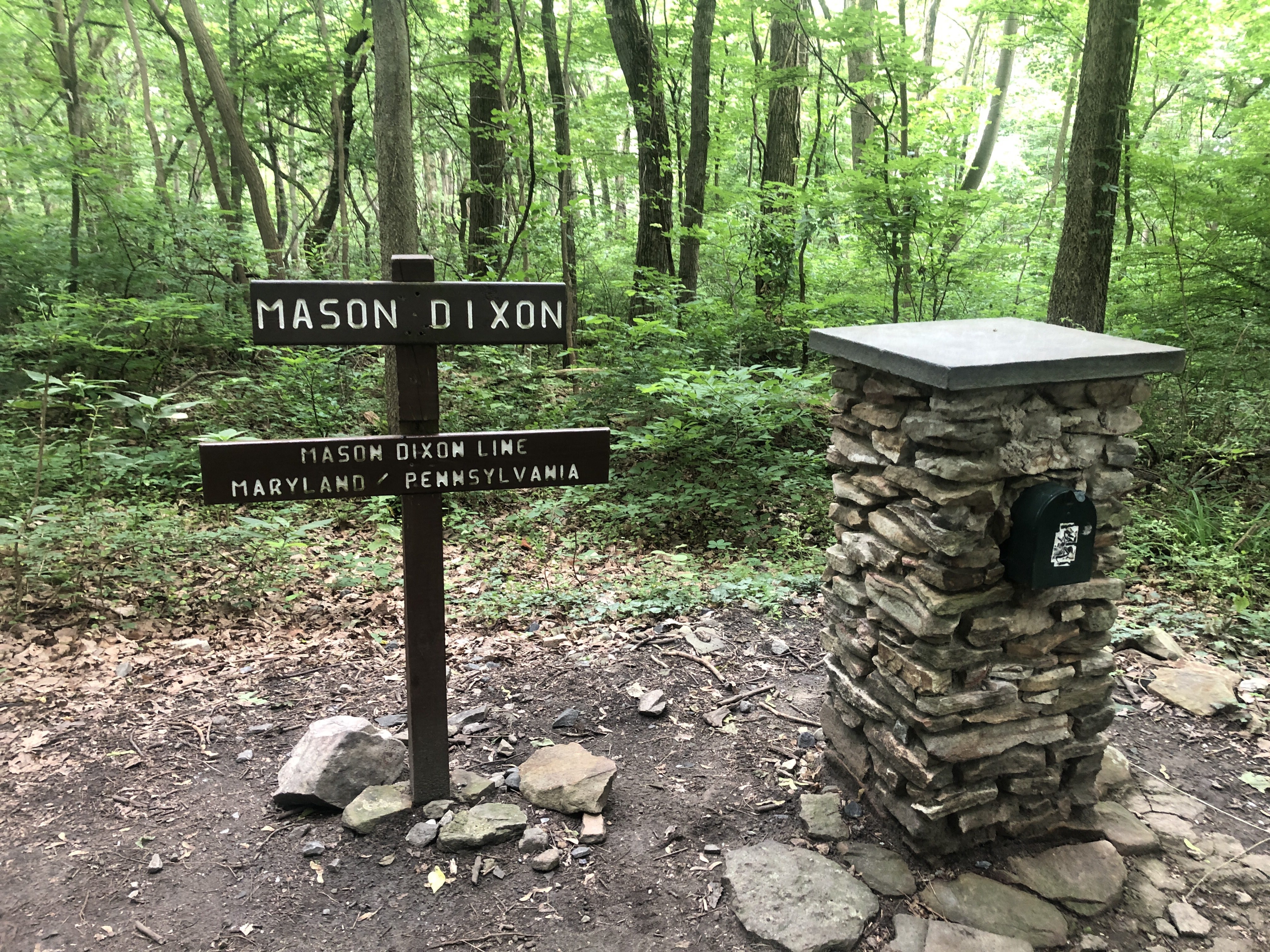
The trail is currently 2192 miles, but over the years it’s changed length. For example, it was once 2180 miles. So the halfway point has shifted over the years.

So this was on the side of the trail at mile 2196. The current 1/2 mile point.
At one time this was the midpoint and the display is much more glamorous. Flags, distances, and more. Nearby is a mailbox with a registry. I added an entry saying I dedicate this hike to my father – the source of my Tartan trailname.
I thought the details in the metal plate were interesting. All the states along with the start and end.

Pennsylvania Rocks

Although this picture was taken in Maryland this is what Pennsylvania is known for – rocks, jumbled rocks, boulder rocks, slow to traverse rocks, twist an ankle rocks – yee gads!
Now I’m officially in Pennsylvania. Let the real rocks begin!
But a brief intermission to celebrate my 70th birthday with cousin Art and the children. At the Ash #8 campsite at Greenbrier SP awaiting their arrival. Tomorrow is a zero day to resupply and celebrate.

Going by Greenbrier State Park

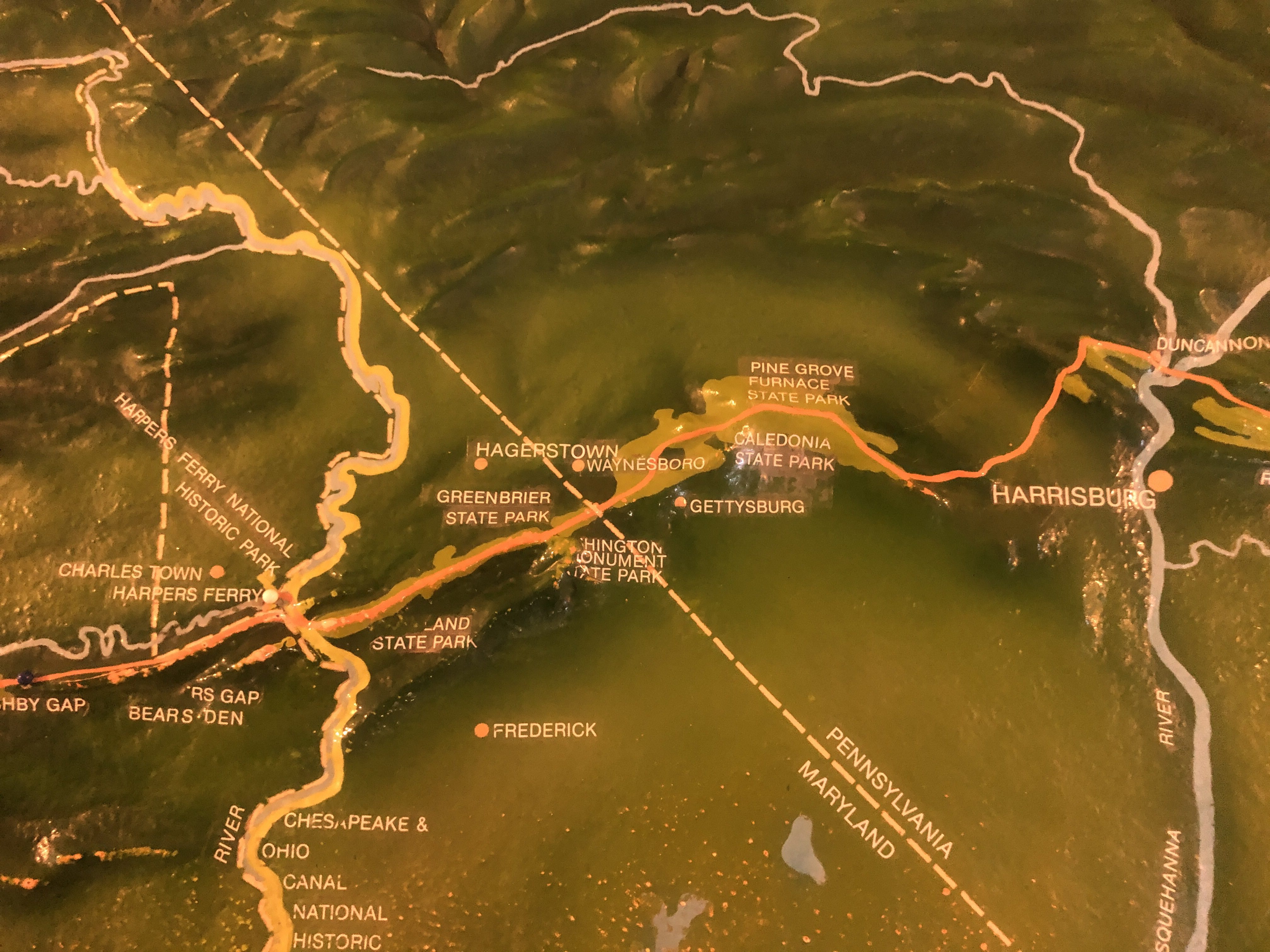
Originally I planned to meet cousin Art at Greenbrier State Park on June 21st. However that would require me to slow down and make it hard/impossible to meet his brother Dave at Delaware Water Gap on July 5th. So instead I sped up to overshoot the park. But now I need to shuttle back to the park on Friday 6/21, take a zero on Saturday 6/22, and shuttle back on Sunday 6/23. However this sets me up to meet Dave on or around 7/5 at DWG.

Over night it rained and in the morning it was foggy. Later I hiked above the fog and took this picture.
This would have been the 0.6W side trail to Greenbrier State Park. I won’t be taking it so I passed it and went on to tonight’s shelter which is 9 miles further north. On Friday 6/21 I’ll reach a trailhead at US 30 (mile 1084) and shuttle back to the park. There cousin Art and his children will be car camping and I plan to take a zero day with them resupplying and relaxing before continuing on.

Harpers Ferry

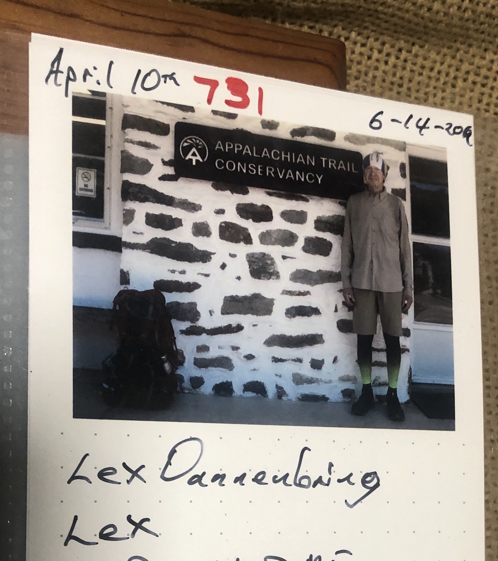
Harpers Ferry is the home of the Appalachian Trail Conservancy (ATC). I got my picture taken (#820), and had my information added (date started, name, trailname, home town, and email address) to their 2019 Album of hikers. In their hiker lounge I filled my water bottles, charged my battery, tossed my garbage, bought and drank four cans of Coca-Cola. When my battery was charged I left and went to get some ice cream but it was too early. So I headed out and got back on the trail.

On the bridge leading into Harpers Ferry over the Shenandoah River.
In the ATC Visitor Center was a relief map of the entire trail GA to ME. My next stop is Greenbrier State Park and a meet-up with cousin Art Rodgers. He will be car camping with his children and I’ll be in my tent. This is my next resupply, shower and laundry. I am especially looking forward to the shower and laundry.
Bilbo’s brick at the ATC proving that I was there and I found it. He was absolutely crucial in my current plan to get to Greenbrier SP and overshooting it to allow me to see both Art and his older brother Dave.
This is my hiking buddy Lex’s ATC picture from four days ago. He is 50-100 miles ahead of me and I doubt I’ll be able to catch him unless he takes more zeroes. All the best Lex!
The hiking pole on the left has a tip whereas the one on the right has worn it down. I have more at home. So I’ve asked Kathy to send one. I’ll get it in three weeks when Dave Rodgers meets me in Delaware Water Gap around 7/5.

1000 miles

Denton Shelter was a “country club”. It was the best shelter so far. It had two level sleeping, a front porch with chairs, a pavilion with picnic table, horseshoe pitch, and even a solar shower. Wow! I shared it with 10-15 scouts and their leaders along with two other thru-hikers.
Major major major achievement – 1000 miles hiked from Georgia to northern Virginia.
At the top of a climb was someone taking a picture of the view. See I’m not the only one! So I thought I’d take a picture of him taking a picture or at least looking at the view. Down below is VA 16 and I could hear the car noise as I climbed. Soon I would descended down to it, carefully cross it and climb up the next mountain.

Zoom I go

Early morning panoramic view
Good morning sun!
Hi there. Here I am about 60 days into the hike.
A view through a gap in the rocks to the clouds and trees below
An open section without trees that let you see the valley below
I liked how the sun and shade feel on the hills in the distance
Not exactly a free tunnel but more like a green corridor. Everything just grows and grows
My hiking poles at a water stop. I think of them as my hiking canes!
Bilbo, who hiked with me on the PCT, helped me resupply today in Front Royal. It was so nice to see my hiker friend who understands exactly what I’m going through. His familiarity with this section of the AT really helped me plan getting to my cousin Art next week and his brother Dave two weeks later. Thank you so much
Tonight’s Shelter is the most extravagant shelter I’ve been to. It has a porch, chairs, a pavilion, a solar shower, along with the normal privy and nearby spring