As a traveler, a stranger in a strange land, I’ve had to depend on others to get where I needed to go. The generosity and kindness I’ve received on this journey so far has been eye-opening. People talk about how isolated and uncaring we have become. Well from my point of view it’s the opposite. Total strangers have taken time and energy to support me on my pilgrimage. I have a hard time expressing my appreciation for what they have done for me so far. From driving for hours to get me towards my goal, to sheltering me, to giving me a warm meal and comfortable bed for a night, but most of all to accepting, talking with and listening to this solo sojourner on his journey. For these offerings of yourselves I thank you. I am in your debt forever.
Category Archives: Preparation
Snow Course
Terry and I arrive at 10 and met Ned Tibbits, the instructor, and the other students, Kelly and Jasmine, a mother and daughter team. We got on snowshoes and hiked to Echo Lake where we ate lunch. Along the way Ned stopped frequently to explain various things like reading the clouds and past avalanche areas. After lunch we hiked on the actual frozen Echo Lake. The weather was warm and the snow slushy. At one point I post holed down and my other leg jammed in the slush getting all wet. Shortly afterwards we got off the lake not wanting to break through. At the end of the lake we climbed over some small snow covered hills, but by then we were all tired especially me. So I was glad when we stopped. Hiking 4-5 miles in the snow was exhausting. We set up our tents, got water in a nearby stream, carved a bench and table in the snow, and sat there eating our dinner and chatting about the day. Hopefully I get more sleep tonight .
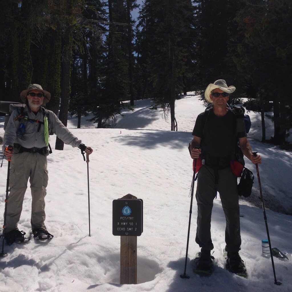
Terry and I at a snow covered Tahoe Rim Trail / PCT marked. By the time we get here they’ll be no snow.
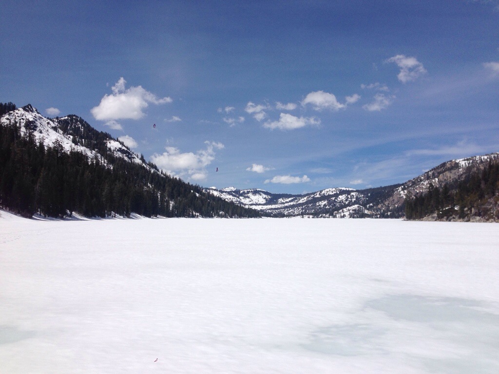
Echo Lake covered in snow and ice. We snowshoed across the lake and beyond to our campsite..
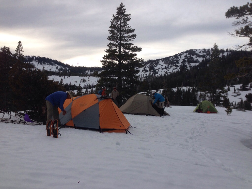
Our encampment.
We woke at sunrise, got dressed, had breakfast, and headed out into the back country at about 9AM. Up numerous hills, across snow bridges over small streams we arrived where we could see Pyramid Peak and numerous other ones. I’ve been slowing the group down because I’m not used to this elevation (about 8000 feet). I’ve had to stop and catch my breath. Also I’m always last – trailing everyone. I have to remember I have to hike my own hike. Next we headed back and went down a steep slope. Sliding and stepping we went down and down. Teaching us how to traverse steep slopes in the snow. It was fun once we got over our initial fear of the height. We got back to camp at about 4:30 PM exhausted.
On the last day we did safe ascent and descent. Without snowshoes we learned how to use our ice axes to slow our descent. This included going down head first on our backs on a steep slope. Simply put we held our ice axes up to our chests with the point out then rolled on our stomach and jammed the point into the snow which caused us to swing around head first and then to slow and stop our descent. After numerous attempts we headed back to camp, got our packs and headed out. It took us about 3 1/2 hours of snowshoeing to get back to our cars, say our goodbyes and head out.
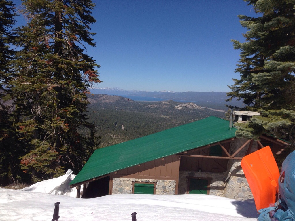
On our return we could see Lake Tahoe in the distance.

Our instructor, Ned Tibbits.
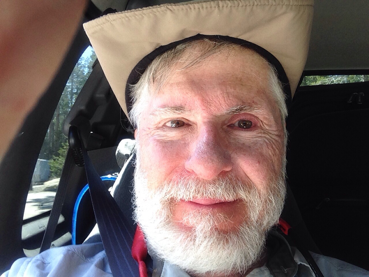
Sunburned me after the weekend course. Now I’m off to start the trail.
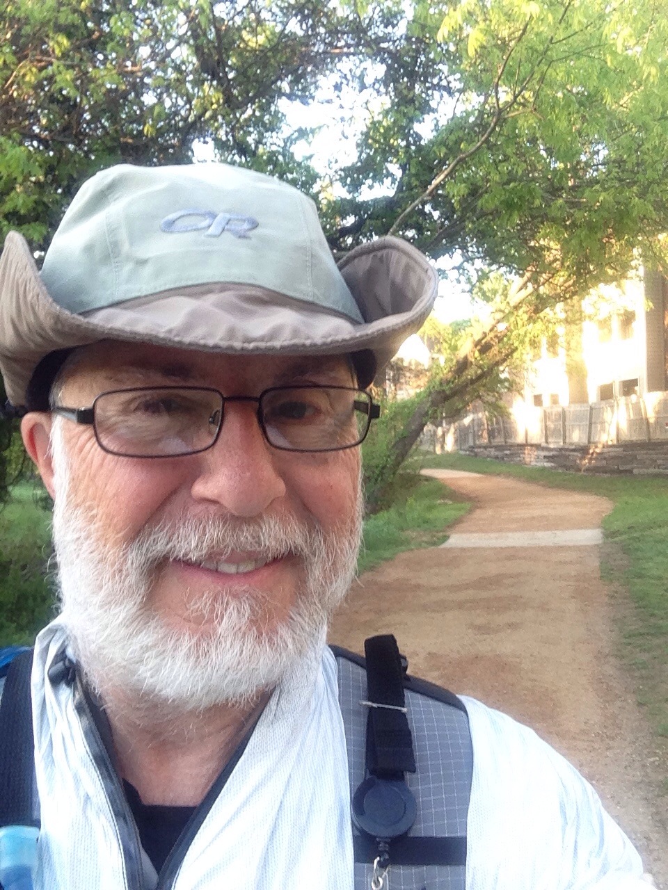
Off I go
Tomorrow I fly to Sacramento CA at 6AM to take Ned Tibbit’s Mountain Education’s Snow Basic course at Echo Lake CA (near South Lake Tahoe) from April 11-13. Thanks to Terry S. who will pick me up and together we’ll attend the course. My equipment is purchased, my prep hiking is done, my resupply plan is prepared, my suitcase is packed, I’ve gone over my resupply with my family and I’m ready to go. For the past few weeks I’ve been waking up early, that is, well before dawn. I think it’s nervous energy. This hasn’t been a problem because I just get dressed and go out and do some prep hiking. This is no longer the case. In a matter of a few days I’ll be on the actual trail and reality will be set in. I wonder if I’ll be able to sleep tonight. Hmmm.


Prep is done
Since last September I have been preparing for my hike. Back then I put together a plan of hiking each day (except for Fridays) and doing this week after week. I started easy with low weight and low mileage and have built up over time adding 10% increase each week. I’ve injected recovery weeks after every 4 weeks where I reduced the weight and distance 30% to let my body heal. [Thanks Steve Sisson for teaching me about training plans.] As a result over these past seven month I have hiked 1600+ miles. In addition each month I did a shakedown camp out at a local state park culminating with a multi-day desert shakedown at Big Bend in February. So am I ready? All I can say is that I’m now done with the prep. Yippee! And I know I can hike 20 miles with a 35 pound pack. And I can camp in a variety of weather conditions. So yes, I think I am.

Resupply as you go
So I have decided to “resupply as you go” where I will buy on the trail and mail it ahead. This will allow me to adapt my eating habits over time and distance. To get started from home I have bought and packed food for Warner Springs which I mailed two days ago. So I will bring with me food for the Snow course and for the start at Campo. Then I will buy at Mt Laguna. Next I will pick up my food at Warner Spring. And so forth from resupply to resupply from just buying, to buy and send, and to just picking-up a package. My resupply plan is in the website pages under Mail Drop List.
However I forgot to include maps with my first package to Warner Springs. So today I am mailing those. They are from Warner Springs to Agua Dulce. I will carry with me from Campo to Warner Springs. Then I will have home send me from Agua Dulce to Kennedy Meadows if I need them. I am wondering if I will use them or not. Only time will tell.

Two weeks to go
On my prep hike today I met some ladies who will be traveling to Ireland for some adventure and hiking. They were out this morning while I was. We first briefly crossed paths as I was doing my Far West – Ladera Norte loop. Then when I was about 100 meters from my car we stopped and chatted. It was nice to hear about their trip. I explained my soon-to-be adventure which elicited “have you read Wild” which I have. I gave them my blog URL. So many wonderful people to meet now and later on the trail. Best wishes ladies. I hope your trip is as exciting as it sounds. May we meet again someday and share our stories.
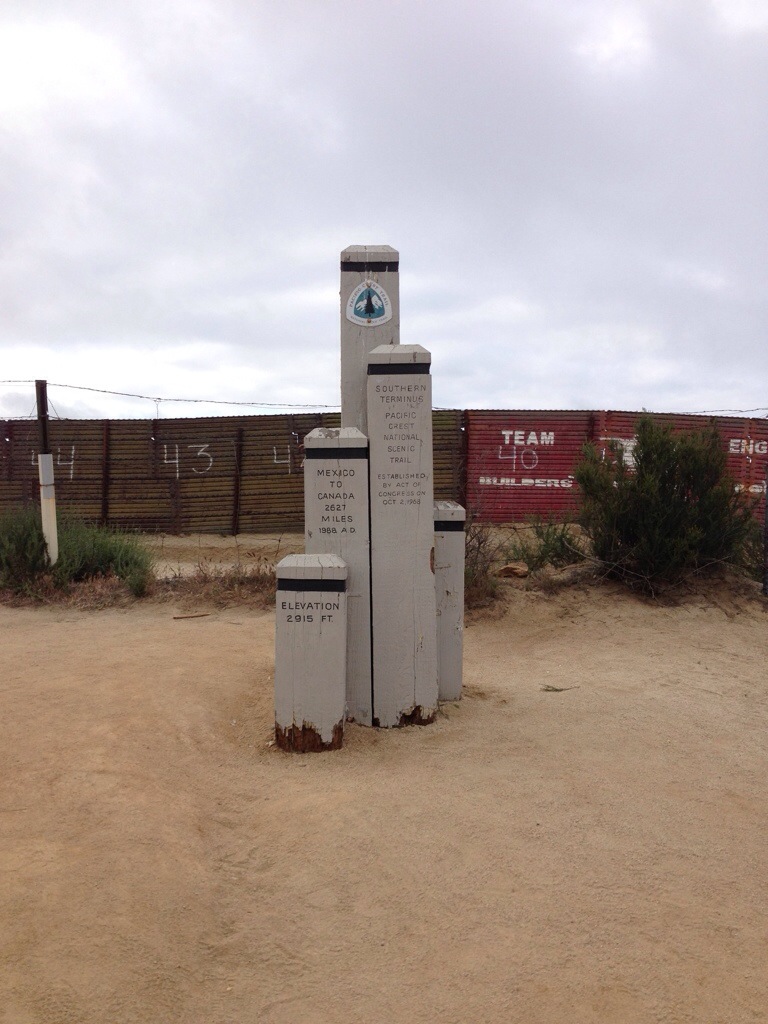
Update: Only two weeks to go until I start from here…
Getting more ready
As I’ve said before I have a preparation plan that I wrote last September and I’m following day-by-day. It hasn’t been easy, because after my hikes my feet have been sore to the point I just sit down, prop up my legs, let them throb and vegetate. However, in the last few weeks I have hiked 20 road miles on Saturday, 15 trail miles on Sunday, and back-to-back 12 & 13 miles each weekday with a 35 pound pack, and guess what… My feet although tired are not painful and I’ve been able to do other things without gimping around like an invalid. So I’m feeling better about the upcoming thruhike and the stresses it’ll place on my body.
I’ve also been working on my resupply strategy, and I’ve decided to “resupply as you go”. This puts pressure on me to buy food and stuff and mail it ahead at certain points along the trail.
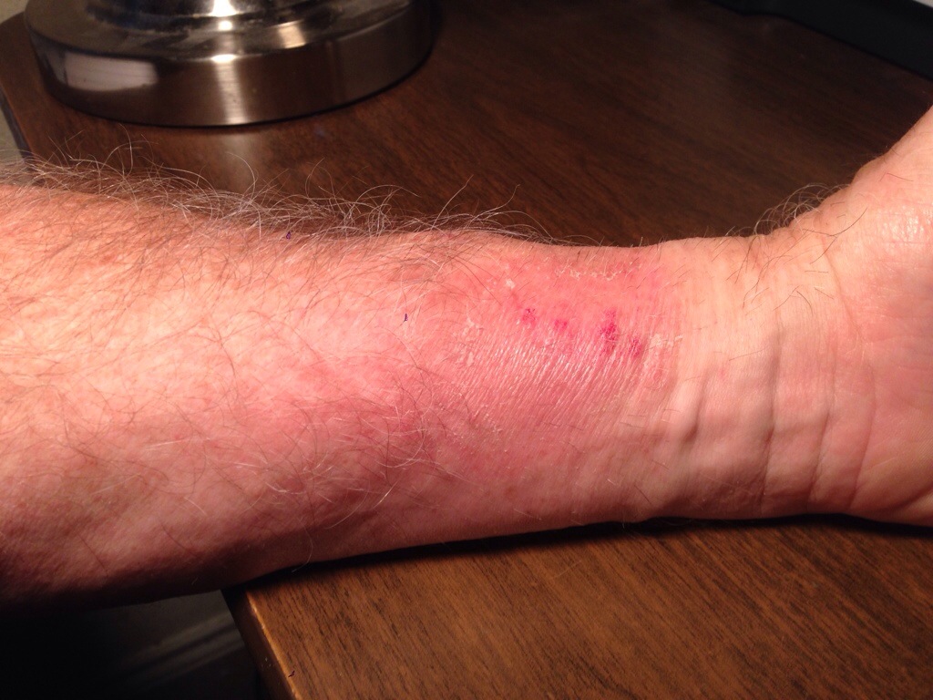
Wrist Rash
Argh! On Saturday as I was hiking on the roads around Austin my left wrist was itchy. I thought I had gotten a mosquito bite, and my watch band was causing it to itch. Not realizing what it was I’d scratch on and off during my prep hike. Now I’ve come to realize that somehow I have gotten poison ivy or oak. However for the life if me I can’t think where I might have gotten it. I didn’t hike on Friday, Thursday was hills on road. That is, I didn’t do any bushwacking, bramblebusting, etc. On Saturday it was just a little red strip, but now it’s a nasty bunch of watery blisters. Oh this is great, because I’ll be starting my hike in just a few weeks. I hope it heals by then. It tells me I had better be careful out on the trail since I’m sensitive to this ucky stuff.
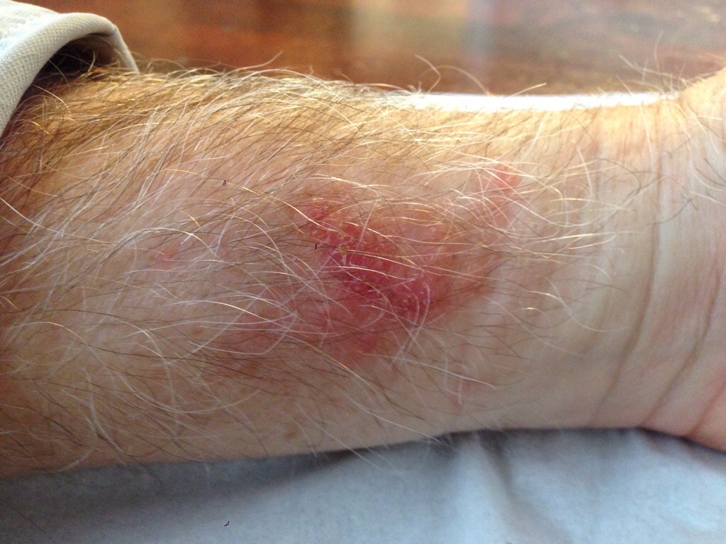
Update: Getting better two weeks later, but it indeed got a lot worse before this picture was taken.
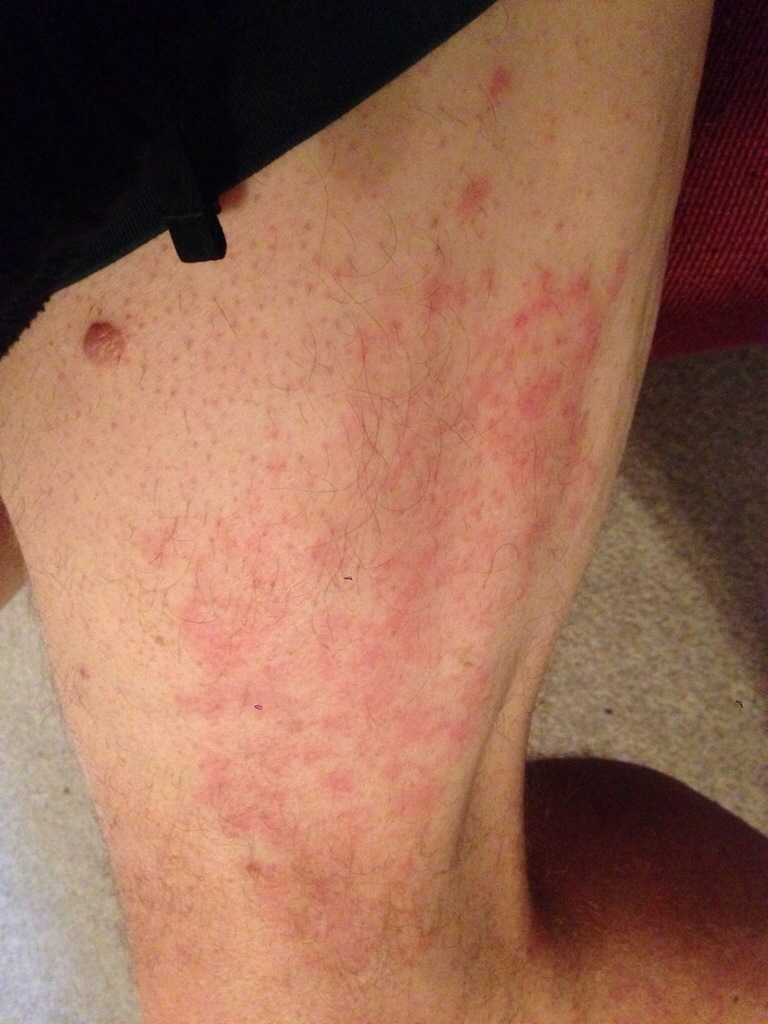
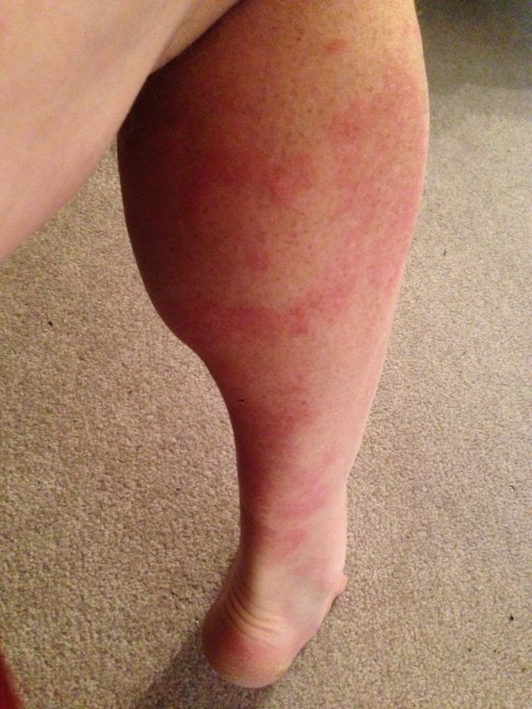
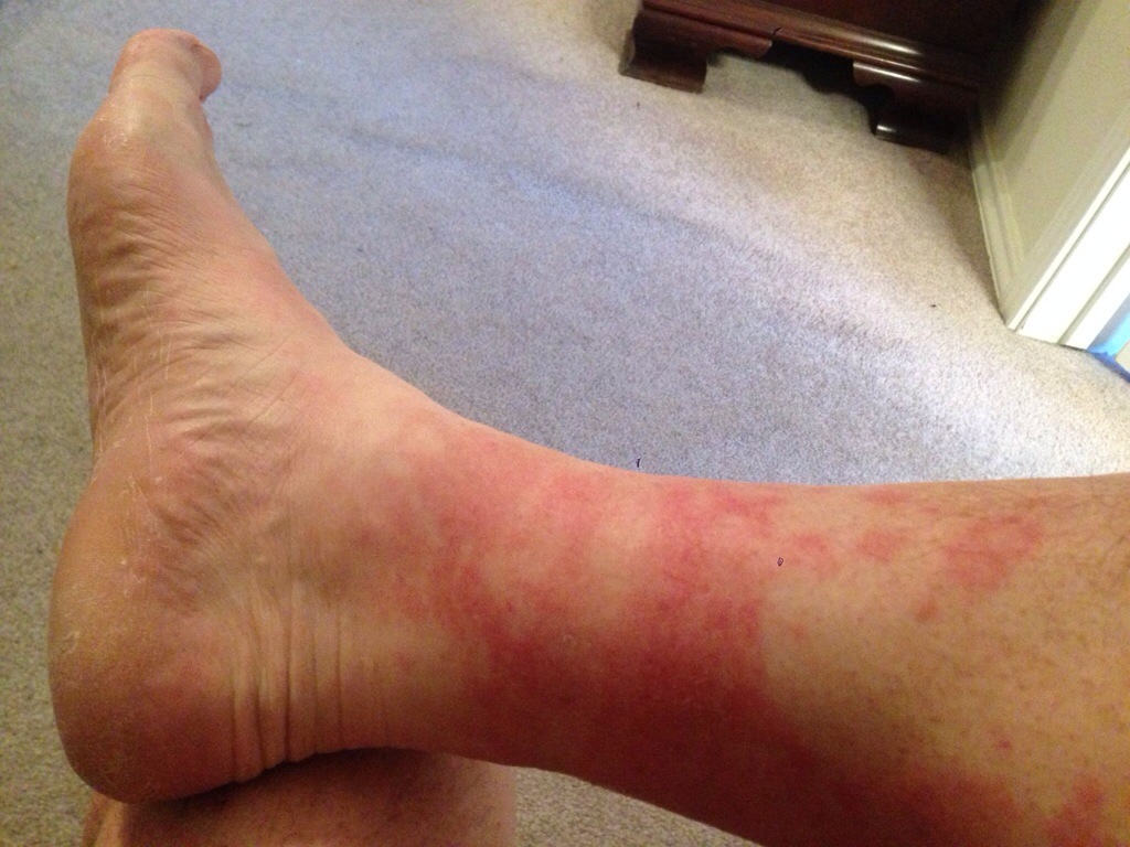
Blotchy Ankles
So yesterday I hiked my longest distance, 20 miles, on the roads in Austin. It took me about 7 hours to complete. Afterwards my legs and ankles had blotchy red patches. What is going on? Then today I hiked my longest trail distance, 15 miles, on the Barton Creek Greenbelt. This time it took about 7 hours too, because it is a lot more rocky & uneven and I used my hiking poles. And the blotches are still there. Then don’t hurt, and only tingled a little when I showered afterwards. I looked it up on Google, and it’s known as “Golfer’s Vasculitis” but didn’t find a solution other than to just let them heal. I just started to wear a pair of SmartWool socks. I wonder if that has something to do with it?

Sharing with friends
It’s so nice that my friends are thinking about me and my upcoming adventure. Just a few minutes ago Kathy F. stopped by and gave me the following present. How nice! Thank you.
